
October 16, 2020
Now that we have been to all 50 states, my husband is trying to "fill in the spaces" on the United States map--traveling to places within the states where we have not been. Since we have been to many of the major cities, that means that he is looking for, shall we say, "out-of-the-way" places to visit. He also is keeping a list of state high points that he has climbed (or driven to). That's how he got the idea to travel to a rather obscure area of the U.S.--the western regions of Oklahoma, Kansas, and Nebraska. He could check three high points off his list and visit a little-known area of the U.S. Perfect.
Looks excitin', doesn't it?


We flew from Ontario, California, to Denver, Colorado. The best part of the flight was that we flew directly over the Grand Canyon. If we've done that before, I have not had a window seat on the correct side of the plane. This time, I had a spectacular view.


Flying over the Rockies a little while later provided quite a contrast!


Is this area of Nebraska predominantly Republican or Democrat? We weren't sure.

With all the windmill farms, we felt like we were on the road to Palm Springs, which also has lots of windmills. Except there were no mountains on this drive. And we were on dirt roads instead of a six-lane freeway. And there were no other cars. And there were no people. Okay, so it didn't feel like the road to Palm Springs.

We came upon this herd of domesticated bison, chomping away in a field.


. . . which kindly permits visitors to drive down a dirt road to the site and charges a mere $3 entrance fee, which is paid on the honor system (which means they probably don't get very many payments).

And here we are! Panorama Point, aka Constable Mountain, located near the Wyoming and Colorado borders. As you can see, it was a cold and windy October day. You can also see that this is not a mountain nor even a hill, but just a swell in the field--if that!


It was actually surprising to learn that the elevation here is 5,424 feet. This is truly the "High Plains"--or the western part of the Great Plains that leads up to the Rocky Mountains.

You know, there are some pretty interesting things in very out-of-the-way places in this vast country of ours.

Besides the stone monument, the Point includes a guest register and a bench.


Bob has been obsessed by climbing all the state high points for years. He has climbed (or driven to) 22 so far, and I have been with him at 16 of those. The hardest one he has done is Mt. Rainier (14,411') in Washington State, and the hardest two I have done with him are Mt. Whitney (14,505') in California and Mt. Elbert (14,439') in Colorado. Panorama Point was a breeze to get to compared to those others, but the dirt roads were a pain.
The reason I bring that up is because "highpointing" is actually a thing. The bench at Panorama Point, for example, was donated by members of the Highpointers Club, whose mission is, among other things, "to promote climbing to the highest point in each of the fifty (50) states." (See https://highpointers.org/)


We had one more place to visit before heading for the corral, er, I mean hotel.


Our next destination: Pawnee Buttes. Check out that sky!

Here's a close-up. Isn't that white stripe around the middle interesting?
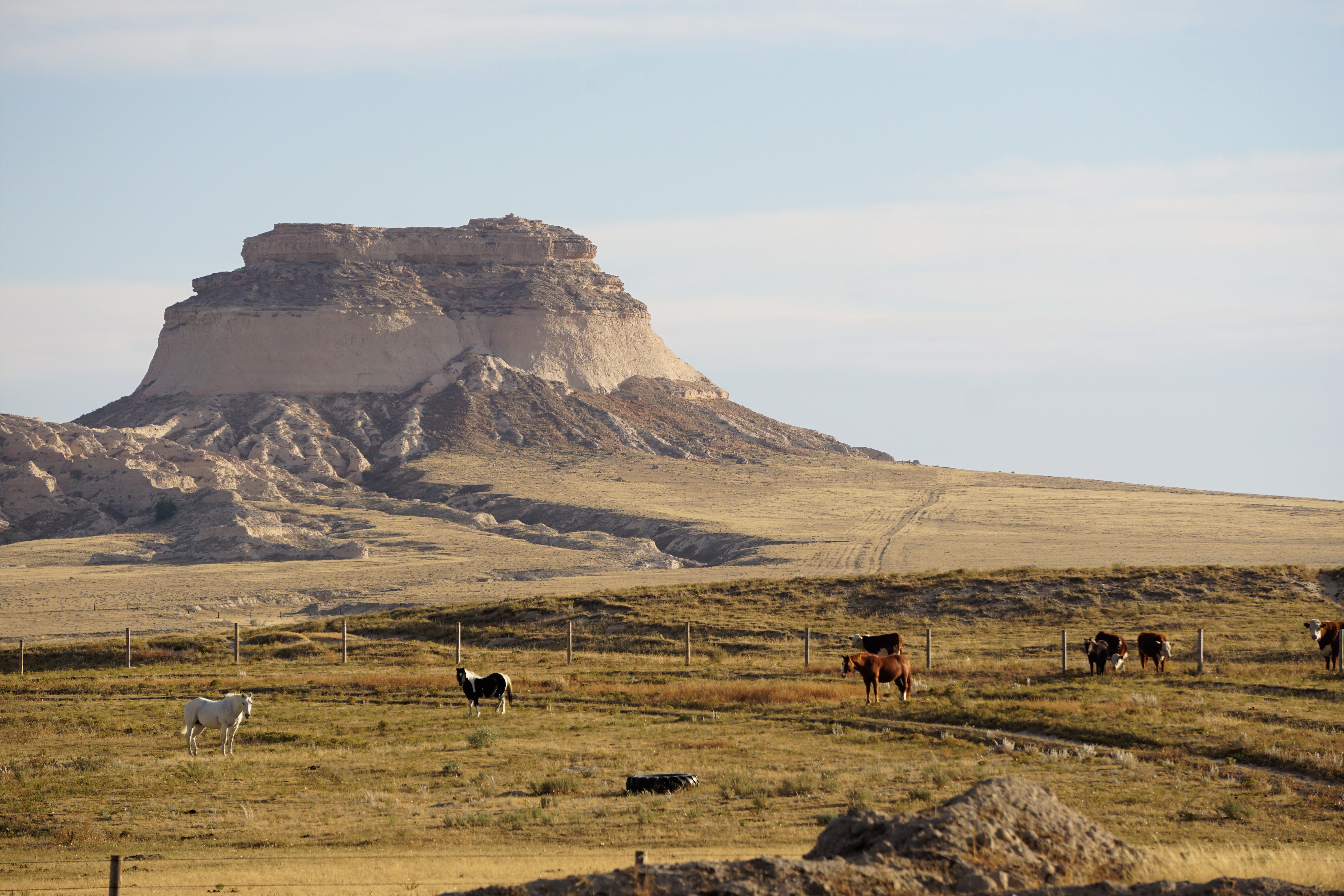

But after seeing it from one side, we took 30 or 40 dirt roads (a direct quote from my notes) to see the buttes from the other side.


The sun was getting awfully close to the horizon, and we had an hour to go to get to Fort Morgan, Colorado, our stopping place for the day.


If you are going to visit all 50 states and only visit the capitols, the cities, you are only getting part of the country. Only watching CNN, not Fox News, or the Farmer's Gazette. The high points take you to parts of the state often rarely visited and round out that 50 state visitation. Aren't you glad I didn't take you high pointing on our honeymoon (I took you rabbit hunting instead)!
ReplyDeleteI really like your depiction on the map of the three high points and the lack of large cities in their vicinity. It helps prove the point of "filling in the spaces." How can you really know the country without visiting the outskirts?
ReplyDelete