July 7, 2024
After leaving the Daniel O'Connell Memorial Church, our goal for the day was to complete the Ring of Kerry Scenic Drive.
We started by driving our car onto the Valentia Island Ferry, which took us across the strait to Valentia Island, a five-minute ride.
From there we drove down most of the length of the island before crossing back to the mainland on a bridge to Portmagee. Supposedly this cuts the road trip time down by 30 minutes.
 |
| The Maurice O'Neill Bridge, photo from here. |
There is a "sub" ring that is part of the Ring of Kerry called the Skellig Ring. That's were we headed first. Just a couple of miles away from Portmagee in that ring is The Kerry Cliffs, one of the most breathtaking places we visited in Ireland and our first stop.
The map below shows our drive from Cahershiveen (where we began our day at the Daniel O'Connell Memorial Church) through the end of the day in Killarney. The black star marks the approximate location of the Kerry Cliffs.
We parked the car and started on a long uphill path to the overlook, passing a field where a Shetland pony was grazing . . .
We also passed a trio of beehive huts similar to what we had see the previous day on the Dingle Peninsula. Unlike those, these were obvious recreations, right down to the tacky plastic birds on top.
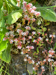
The combination of the kaleidoscopic colors, the foaming surf, the idyllic weather, the craggy precipice, and the delicate flowers was perfection.
There are several viewpoints, and each one requires another ascent up a steep, pebbled road. But oh, is it ever worth the effort!
After soaking up the dazzling views, we headed back down the long road to the parking lot.
. . . and where Bob tried to have a conversation with a donkey.
We finally came to the first viewpoint at the top of a long dirt road. Signage at the site notes that the cliffs rise 1,000 feet above the Atlantic and that their sandstone bedrock was laid down about 400 million years ago.
There was plenty of wildlife to add to the scenery . . .
. . . with helpful signage.
View from another lookout:
I just can't get over the water. Who knew water could be so beautiful?
Look at the drop-off just past the sidewalk in the photo on the left. That gives some perspective to the sign on the right.
What are the two rocks right of center on the horizon? Signage at the site identifies them as Puffin Island and Skellig Michael. A skellig is "a small or steep area of rock."
I've come to a renewed appreciation for the Irish literary bent, and the sign describing those two little islands supports my admiration for Irish writing skills (ignoring spelling and punctuation errors).
The larger of the two is Skellig Michael and is one of only three UNESCO World Heritage Sites in Ireland. A monastic settlement topped this rock between the 7th and 13th centuries. It is possible to visit the monastery ruins. The rock also is home to the second largest gannet (a bird species) colony in the world with 27,000 pairs.
The smaller rock is Puffin Island, the home to 5,000 to 10,000 Atlantic puffins and up to 20,000 petrels, not to mention many other species of birds.
Such an amazing place.
There are several viewpoints, and each one requires another ascent up a steep, pebbled road. But oh, is it ever worth the effort!
Bob tried to engage these alpacas in conversation . . .
Sorry, Bob.


(Bob) Probably my favorite place in Ireland. I would like to go back and take a boat out to Skellig Michael and see the nesting birds. The pictures don't do justice to the beauty. Much more beautiful than the Cliffs of Moher, coming up.
ReplyDelete