July 11, 2024
Wednesday, December 4, 2024
NORTHERN IRELAND, BELFAST CITY TOUR PART II
Saturday, November 30, 2024
NORTHERN IRELAND, BELFAST: THE TITANIC MUSEUM
July 10, 2024
Tuesday, November 26, 2024
NORTHERN IRELAND: BELFAST CITY TOUR - TWO SIDES
July 10, 2024
Friends who visited Northern Ireland a year or two ago recommended a tour they took in Belfast that was split into two parts. Half was led by an Irish Nationalist on the Catholic side of Belfast, and the other half was led by a British Loyalist on the Protestant side of the city. There are several of these tours offered by different companies, and Bob reserved a spot in one that looked good.
Our guide on the Catholic side had been part of the IRA and had spent many years in prison for his role in the fighting. It was crazy because he looked at sounded like a sweet grandpa. Note that he is wearing an Irish-green version of the keffiyeh, which has become a symbol of Palestinian resistance. We learned that the Irish Nationalists identify with the Palestinians as a repressed people and are very anti-Israel.
. . . awaiting his dad who was left in a blaze--and bid no one farewell, not even to his flesh, not even to himself--sees the kite, my kite you made, flying up above, and thinks for a moment an angel is there bringing back love. If I must die, let it bring hope, let it be a tale."
This poem was written by Palestinian Refaat Alareer before he was killed in an airstrike by the Israeli military.
Friday, November 15, 2024
NORTHERN IRELAND: BELFAST - C. S. LEWIS SQUARE AND CITY HALL
July 10, 2024
I was quite excited to go to Belfast, which to me--prior to this trip--had been the center of all the conflict that occurred in Northern Ireland. I remembered the terrible fighting that defined the city during my teen years and well into my 30s. I remember when my mother, a first grade teacher, attended the International Reading Conference in Belfast when I was in my late 20s or early 30s, and how scary that was for me! I was sure she would be blown up!
But from everything we read, Belfast was now a lovely, peaceful city. That turned out to be mostly true, but not completely.
Belfast is the capital of Northern Ireland and has a population of about 350,000. As we drove into town, I was struck again by the artistry of the Irish (although here it would be the British). Murals are everywhere.
This is one of my favorites: My City, My People, My Heart by Dee Crait. I think it honors the laborers, those who keep us fed and housed.
Monday, November 11, 2024
NORTHERN IRELAND: THE GIANT'S CAUSEWAY
July 10, 2024
The Giant's Causeway is a geologic rock formation formed by an erupting volcano 50 or 60 million years ago. The molten basalt seeped through chalk beds to form a volcanic plateau, and as the lava cooled, it cracked, much as mud does when it dries, leaving about 40,000 mostly hexagonal interlocking stones.
According to legend, these columns are the remains of a land bridge, or causeway, built by the Irish giant Fionn mac Cumhail and the Scottish giant Benandonner so that they could meet in the middle and fight it out. The Scottish end, which supposedly looks like the Northern Irish end, is called Fingal's Cave.
This early-19th century poem presents a slightly different motive behind building the causeway:
THE GIANT'S CAUSEWAY
They met beside the stormy sea, those giant kings of old,
And on each awful brow was set, a crown of burning gold.
No ray the yet unrisen stars, or the wan moonbeams, gave,
But far and bright, the meteor light shone over cloud and wave.
"I have been over earth to-day," exclaimed one mighty king,
"The toil of half the human race, it is a foolish thing;
For I have seen on Egypt's land, an abject million slave,
To build a lofty pyramid above their monarch's grave.
"Now let us put their works to scorn, and in a single night
Rear what would take them centuries, and nations' banded might,"
Then up arose each giant king, and took a mighty stone,
They laid the quay; they piled the rocks—ere morn the work was done.
Vain fable this! yet not so vain as it may seem to be,
Methinks that now too much we live to cold reality;
The selfish and the trading world clips man so closely round,
No bold or fair imaginings within our hearts are found.
So vortex-like doth wealth now draw, all other feelings in,
Too much we calculate, and wealth, becomes almost a sin;
We look upon the lovely earth, and think what it may yield;
We only ask for crops, not flowers, from every summer field.
The mind grows coarse, the soul confined, while thus from day to day
We let the merely common-place eat phantasie away:
Aye, better to believe, I trow, the legends framed of old—
Aught—anything to snatch one thought, from selfishness and gold.
-Leticia Elizabeth Landon (1802-1838)
The Giant's Causeway was declared a World Heritage Site in 1986. In 2005, a poll named the Giant's Causeway the fourth-greatest natural wonder in the United Kingdom.
We arrived at the visitor center and left our car in the parking lot, for which we had prepaid about $40. That included access to the visitors center (and the bathroom, which made it worth every penny).
Sunday, October 27, 2024
NORTHERN IRELAND: DERRY/LONDONDERRY, PART II (THE BOGSIDE)
July 9, 2024
We met our guide, whom Bob had booked through Derry Blue Badge Guide, at Guild Hall, a beautiful building originally used for tax collecting and as a town hall and now the seat of local government. The current building was erected in 1912 after the previous one burned down. During "The Troubles," which I'll explain in a minute, this building suffered damage in multiple terror attacks. When Bill Clinton visited Derry in 1995, he gave a speech in the large square in front of the Guildhall.
Our guide was excellent. When "The Troubles" began in the late 1960s, he left the country in order to escape being embroiled in the conflict. He returned when it all ended. Though he was not present, he was well-informed. He knew and was passionate about Derry's and Ireland's history, particularly from the time "The Troubles" began in the 1960s to 1998 when they ended.Tuesday, October 15, 2024
NORTHERN IRELAND: DERRY/LONDONDERRY, PART I (CITY WALLS, ST. COLUMB'S CATHEDRAL, AND MORE)
July 9, 2024
We drove from Drumcliffe Church outside of Sligo to Londonderry/Derry, Northern Ireland, actually part of the United Kingdom and therefore a different country than the Republic of Ireland. Brits call the city Londonderry and Irish Republicans call it Derry. From here on out, I will refer to it as Derry for ease of typing.
There was no indication that we had left Ireland and entered Northern Ireland--no signs that said "Leaving the Republic of Ireland" or "Welcome to the United Kingdom" or even "Change your euros to pounds here." We made it into Derry and parked the car near an interesting series of photos on the city walls near the Heritage Tower.
Saturday, October 5, 2024
IRELAND, DAY 6: SLIGO'S YEATS TRAIL
July 9, 2024
After I spent a few minutes with the statue of Yeats in Sligo, we got on the "Yeats Trail," which takes visitors to several sites around Sligo that are somehow connected to the famous author.
Our first stop was Sligo Abbey, now in ruins but once a flourishing Dominican convent founded in 1253 and operating until 1760.
Unfortunately, we arrived at 9:10 AM and it didn't open for tourists until 10:00--too long to wait.
Tuesday, October 1, 2024
IRELAND, DAY 5: SLIGO
July 8, 2024
Sligo, population 20,000, is located on the coast just west of Northern Ireland.
Sunday, September 22, 2024
IRELAND, DAY 5: CLIFFS OF MOHER
July 8, 2024
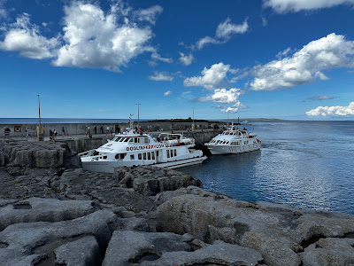
A 2.25 hour drive got us from our hotel in Castleisland to the Cliffs of Moher, the #2 attraction in Ireland after the #1 Guiness Brewery Tour (which was not on our itinerary). In 2022, the Cliffs got about 1.1 million visitors, 41% of whom were from the United States.
There are two ways to see the cliffs: tourists can 1) walk along the top of the cliffs, or 2) take a sightseeing cruise. We thought we'd see more from the water than from the top, so before we left home, Bob purchased tickets (€26 each) for a boat tour.
Sunday, September 15, 2024
IRELAND, DAY 4: THE SKELLIG RING AND RING OF KERRY SCENIC DRIVES
A little further on, and on its own little island accessible from the beach when the tide is out (which it was), we came across the ruins of the 6th century Derrynane Abbey, built on a monastic site founded by St. Finnian of Clonard (one of the fathers of Irish monasticism) during the 5th century.
 |
| Photo from here |


